
KUALA LUMPUR, MALAYSIA — By Ir Vimal | Published on October 25, 2023
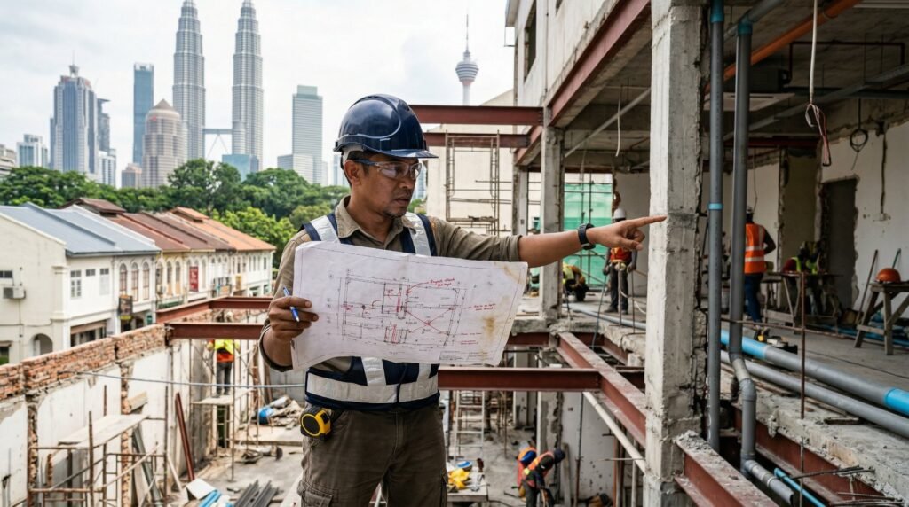
Malaysia’s urban landscape is evolving at breakneck speed. From towering strata developments in the Klang Valley to heritage restorations in Penang, construction and renovation projects are ubiquitous. However, amidst the rush to build and upgrade, property owners and developers often overlook a crucial element: the accuracy of as-built drawings Malaysia. Relying on outdated or inaccurate blueprints is not just an administrative oversight; it is a ticking time bomb that can lead to catastrophic structural failures, massive financial losses, and severe legal liabilities.
Recent news of structural compromises and sinkholes in urban hubs highlights the absolute necessity of precise underground utility and structural mapping. As enforcement from local authorities (PBTs) and the Construction Industry Development Board (CIDB) becomes stricter, maintaining precise documentation is no longer optional. Let’s dive deep into the hidden dangers of inaccurate plans and how modern engineering solutions are mitigating these risks.

1. What Are As-Built Drawings?
Unlike the original design blueprints (which represent what was intended to be built), as-built drawings reflect the exact dimensions, geometry, and locations of all elements as they were actually constructed. Throughout any construction project, contractors make on-site modifications to address unforeseen challenges—such as rerouting a plumbing line or adjusting a structural column. If these changes are not officially recorded by professional as-built drawing services, the final handover documents will not match the physical reality of the building.
3. Legal and Financial Repercussions in Malaysia
Local Authority (PBT) Compliance
In Malaysia, the Street, Drainage and Building Act 1974 strictly governs building modifications. Submitting renovation plans to local councils (like DBKL or MBPJ) based on flawed base drawings will result in rejected permits, hefty fines, and stop-work orders. Furthermore, if a neighboring property is damaged during your renovation due to inaccurate boundary or structural assumptions, you could face severe litigation.
Protecting yourself requires preemptive measures. Conducting a Dilapidation Survey on adjacent properties, coupled with precise as-built data, acts as a critical insurance policy against unwarranted claims.
Dispute Escalation
Discrepancies between what was contracted and what was built are a leading cause of litigation in the Malaysian construction sector. When disputes arise over payment, defect liabilities, or unapproved variations, having irrefutable documentation is crucial. In such legal battles, relying on an Expert Witness & Dispute Resolution service that utilizes highly accurate spatial data can definitively sway a tribunal or court decision.

4. The Modern Fix: 3D LiDAR and BIM
The traditional method of manual tape measuring and 2D sketching is notoriously error-prone and labor-intensive. To eliminate the dangers of human error, the industry has turned to cutting-edge technology.
Precision Through 3D LiDAR Scanning Services
Modern surveying utilizes 3D LiDAR scanning services to capture millions of data points per second, creating a millimeter-accurate “point cloud” of a building. This technology maps every architectural nuance, exposed utility, and structural defect with unprecedented precision. For a deeper understanding of how this technology can safeguard your investment, explore comprehensive As-Built Survey & Drawing Services.
Future-Proofing with BIM Modeling Malaysia
The point cloud data generated by LiDAR is commonly converted into a Building Information Model (BIM). The adoption of BIM modeling Malaysia is heavily championed by the Construction Industry Development Board (CIDB) to enhance project efficiency. A comprehensive BIM model does not just show 3D geometry; it contains embedded data about materials, lifespans, and maintenance schedules, creating a “digital twin” of your physical asset.
5. Long-Term Value in Facility Management
The usefulness of accurate as-built drawings extends far beyond the construction phase; they are the backbone of effective facility management Malaysia. Under the Strata Management Act 2013 (SMA), Joint Management Bodies (JMBs) and Management Corporations (MCs) are legally obligated to maintain common properties efficiently.
Without accurate mechanical and electrical (M&E) layouts, routine maintenance becomes a game of guesswork. Precise documentation allows facility managers to locate shut-off valves rapidly during emergencies, plan efficient upgrades, and conduct effective Periodic Building Inspections as mandated by local laws. For high-rise properties, even the exterior must be accurately mapped. Combining updated drawings with a Façade & Roof Inspection (Drone) ensures comprehensive oversight of the building’s envelope, preventing falling debris hazards.
6. Frequently Asked Questions (FAQ)
Why are accurate as-built drawings crucial for property defect inspections?
During the Defect Liability Period (DLP), inspectors need to verify if the built environment matches the developer’s promised specifications. Accurate drawings provide the baseline for this comparison. Learn more about protecting your rights through professional Property Defect Inspection (DLP) services.
How do 3D LiDAR scanning services compare to traditional surveying in Malaysia?
Traditional surveying relies on manual measurements which can be time-consuming and prone to human error, especially in complex or hard-to-reach areas. 3D LiDAR captures millions of precise data points in minutes, ensuring millimeter accuracy and entirely eliminating spatial blind spots.
Is BIM modeling mandatory for all construction projects in Malaysia?
While not universally mandatory for private, small-scale projects yet, CIDB Malaysia has been pushing for widespread BIM adoption. It is highly recommended and increasingly required for large-scale public and private sector projects to improve lifecycle management and prevent costly errors.
Don’t Let Inaccurate Plans Sabotage Your Project
Whether you are planning a massive commercial renovation, navigating a structural dispute, or simply trying to optimize your building’s facility management, the foundation of your success lies in accurate spatial data. Relying on outdated plans is a gamble you cannot afford to take in Malaysia’s stringent regulatory environment.
At Pro Inspect Solution, our certified engineers utilize cutting-edge LiDAR and BIM technologies to deliver uncompromising accuracy. Secure your asset’s future today.
 (3)")