
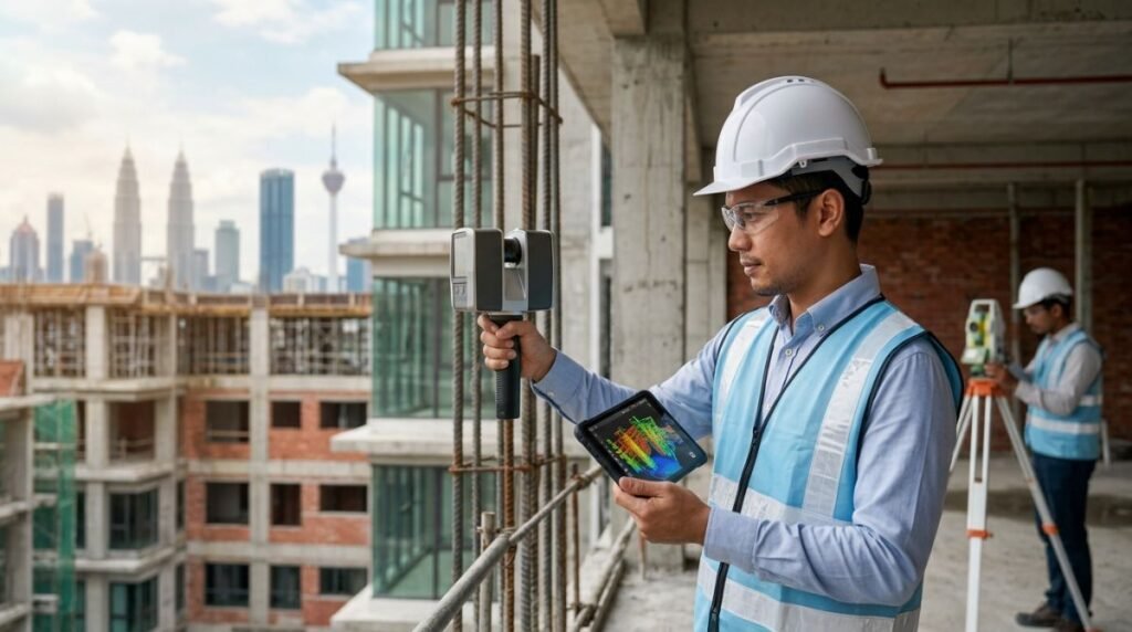
KUALA LUMPUR, MALAYSIA — October 5, 2026 | By Ir Vimal, Professional Engineer
As Malaysian real estate and commercial construction reach unprecedented vertical density, developers and principal contractors face tightening statutory accountability under the Construction Industry Development Board (CIDB) digital mandates. The persistent divergence between approved engineering drawings and physical as-built dimensions has led to compounding strata title friction, structural misalignment, and costly rectification during the Defect Liability Period (DLP). Discover how high-definition 3D LiDAR dimension surveys eliminate dimensional ambiguity, bridge the reality gap, and drive millimeter-accurate BIM integration.
The Reality of As-Built Dimension Flaws in Malaysian Developments
In the high-stakes construction ecosystem across the Klang Valley, Penang, and Johor Bahru, structural handover delays increasingly stem from invisible dimensional variances. Even minor discrepancies between structural floor plans and on-site reinforced concrete casting can jeopardize compliance under the CIDB Malaysia Quality Assessment System in Construction (QLASSIC) framework and the Uniform Building By-Laws (UBBL 1984).
When columns drift out of plumb, transfer slabs experience uncalculated deflection, or internal boundary walls deviate by mere centimeters, the consequences cascade throughout the asset lifecycle. Mechanical, Electrical, and Plumbing (MEP) risers clash with structural beams, pre-fabricated modular elements fail to align, and property developers face immediate statutory pushback during vacant possession under the Strata Management Act 2013 (Act 757). If structural load paths are inadvertently altered through casting deviations, engaging independent Structural Repair Consultancy becomes mandatory to assess structural safety, re-calculate load distribution, and prevent long-term structural distress.

Manual Measurements vs. Terrestrial 3D LiDAR: Error Comparison
For decades, Malaysian building contractors relied on traditional tape measurements, total stations, and handheld optical laser distometers to compile as-built records. While acceptable for basic orthogonal layouts, manual methods fail to capture spatial curvature, progressive column leans, slab sags, and ceiling camber across vast multi-storey developments.
Terrestrial 3D LiDAR dimension surveys deploy high-frequency laser arrays that pulse millions of coordinates per second across 360-degree fields of view. The resulting spatial dataset—a dense, millimeter-accurate point cloud—documents the true physical condition of a structure without subjective interpolation.
| Survey Metric | Traditional Manual & Distometer Survey | Terrestrial 3D LiDAR Scanning |
|---|---|---|
| Measurement Accuracy | ±10mm to ±25mm (subject to human parallax error) | ±1mm to ±2mm (millimeter-level absolute precision) |
| Data Density | Discrete single-point sampling (sparse grid) | Up to 2,000,000 points per second (full surface envelope) |
| Complex Geometries | Incapable of measuring progressive verticality or slab deflections | Captures 3D camber, plumb drift, and surface flatness heatmaps |
| Survey Duration (10,000 sq ft) | 3 to 5 business days with multiple technicians | 2 to 4 hours on-site with zero workflow disruption |
| BIM & Digital Twin Compatibility | Requires laborious manual drafting and guesswork | Native point cloud ingestion into Autodesk Revit, Navisworks & ArchiCAD |
| Statutory Evidentiary Value | Frequently challenged in Strata Management Tribunal disputes | Indisputable, timestamped, tamper-proof spatial documentation |
End-to-End Workflow: From Raw Point Cloud to Autodesk Revit BIM Twin
Modern building governance mandates close synergy between field scanning and digital modeling. Capturing laser scans is only the first milestone; converting raw data into actionable spatial intelligence drives real construction ROI. At Pro Inspect Solution, our engineering teams bridge scan data into Building Information Modelling (BIM) through a rigorous four-phase protocol:
- Survey Control & Terrestrial Acquisition: Engineers establish calibrated geodetic survey control points across the site using high-precision targets. Terrestrial 3D LiDAR scanners capture external facades, structural cores, transfer plates, and ceiling voids. For complex high-rise envelopes, this scan data is cross-referenced with photogrammetric data gathered via aerial Façade & Roof Inspection (Drone) platforms to achieve an unbroken digital envelope.
- Point Cloud Registration & Noise Filtration: Raw multi-station scans are stitched and registered within point cloud processing engines. Stray data artifacts (such as passing workers, dust, or temporary formwork) are filtered out, generating a unified, georeferenced spatial coordinate dataset (.RCS/.RCP or .E57 format).
- BIM Ingestion & Autodesk Revit Integration: The registered point cloud is imported directly into Autodesk Revit. Modelers construct parametric components (structural columns, shear walls, MEP distribution runs, floor slabs) snapped directly to the physical point cloud geometry rather than idealized design drawings.
- Clash Detection & Deviation Heatmap Analysis: Using Autodesk Navisworks and specialized point-to-mesh deviation software, the team runs automated clash detection between the designed architectural model and the true as-built geometry. Color-coded deviation heatmaps flag out-of-tolerance variances exceeding permissible limits under MS 1064 and BS EN standards, allowing site managers to rectify structural deviations before architectural finishes are applied.

Eliminating DLP Disputes and Strata Title Area Discrepancies
Under the Housing Development (Control and Licensing) Act 1966 (Act 118) and the statutory Sales and Purchase Agreement (Schedule G and H), developers must deliver units adhering strictly to approved floor layout specifications. Historically, the Defect Liability Period (DLP) produces bitter legal stalemates when purchasers discover that actual usable floor areas are smaller than documented, or that partition walls deviate from the certified Schedule of Parcels filed under the Ministry of Housing and Local Government (KPKT).
Deploying 3D LiDAR during formal Property Defect Inspection (DLP) establishes an indisputable baseline of reality. Floor flatness (FF) and floor levelness (FL) numbers are quantified mathematically, eliminating subjective arguments between contractors and property owners. When dimensional discrepancies affect partition clearances, strata parcel boundaries, or common property allocations, the timestamped point cloud provides the exact spatial evidence necessary to settle claims equitably.
Legal and Structural Audits: Expert Witness & Dilapidation Surveys
In densely populated Malaysian urban cores, adjacent construction—such as deep basement piling or MRT tunneling—frequently causes localized ground settlement and lateral displacement of neighboring properties. When surrounding structures exhibit cracking or tilting, establishing liability requires precise comparative data.
Carrying out an engineering-grade Dilapidation Survey reinforced with 3D LiDAR establishes an immutable pre-construction dimensional record. Should structural movement occur during piling or excavation, follow-up laser scans immediately isolate millimeter-scale differential settlement, wall shearing, or structural plumb deviations.
“In statutory tribunals and court proceedings, manual tape measurements and visual photographs are easily challenged. An immutable, millions-of-points 3D LiDAR point cloud signed off by a Professional Engineer provides definitive, scientifically unassailable proof of structural movement or as-built non-compliance.”
— Ir Vimal, Professional Engineer
Frequently Asked Questions (FAQ)
What is the measurement tolerance of a 3D LiDAR as-built dimension survey?
High-precision terrestrial 3D LiDAR scanners deliver an accuracy tolerance of ±1mm to ±2mm across standard scanning ranges. This precision easily captures structural plumb errors, slab deflections, and room dimensional variances that conventional manual tape measurements overlook.
How does 3D LiDAR resolve Strata Management Act 757 disputes in Malaysia?
Under Act 757, strata parcel boundaries and accessory parcel allocations must strictly match the approved Schedule of Parcels. 3D LiDAR scans extract exact as-built square meterage and boundary alignments, providing incontrovertible spatial data for the Strata Management Tribunal to resolve vacant possession discrepancies.
Can 3D LiDAR point cloud files be imported directly into Autodesk Revit?
Yes. Registered point cloud datasets (.E57, .LAS, or .RCS/.RCP formats via Autodesk ReCap) integrate directly into Autodesk Revit. This allows BIM managers to model as-built structural elements, run clash detections, and build comprehensive Scan-to-BIM digital twins for ongoing facilities management.
At what stage of a construction project should a 3D LiDAR dimension survey be conducted?
A 3D LiDAR survey is most effective at three key milestones: post-structural frame completion (to verify column verticality and slab flatness before architectural fitting), prior to MEP installation (for spatial clash avoidance), and immediately prior to Certificate of Completion and Compliance (CCC) inspection for final handover verification.
Contact Us / Professional Inspection & Engineering Consultation
Pro Inspect Solution, led by Ir Vimal, Professional Engineer, provides professional building condition assessments, structural integrity audits, handover defect inspections, and professional engineering advisory across Malaysia.
- 📍 Service Coverage: Kuala Lumpur, Selangor, and Nationwide Malaysia
- 📞 Phone / WhatsApp: +60 16-806 4902
- ✉️ Official Inquiries: inspectsolution.pro@gmail.com
- 🌐 Official Website: proinspectsolution.com
- 👷♂️ Lead Engineer: Authored & verified by Ir Vimal, Professional Engineer
Need Professional Property Inspection or Building Audit Services?
Get instant consultation and professional engineering advice from Pro Inspect Solution.
