
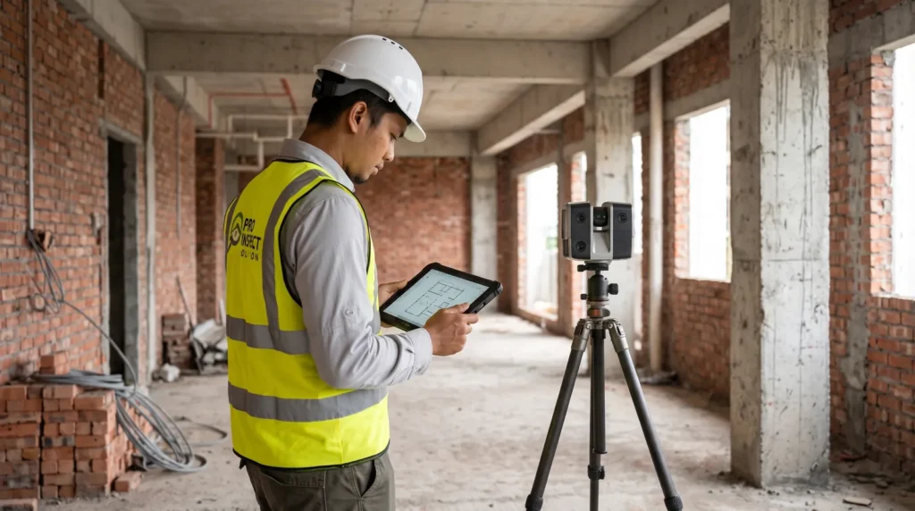
An as-built dimension survey measures a building as it actually stands. It records room sizes, wall and ceiling heights, openings, structural element sizes and floor levels, and shows where they differ from the design drawings. Owners, designers and contractors use it for renovation, fit-out, M&E retrofit, defect investigation and BIM, wherever the old drawings can’t be trusted.
Modern as-built surveys combine LiDAR scanning with tape and laser distance checks. Accuracy should be stated as a band at a confidence level, using the USIBD Level of Accuracy (LOA) scale, not as a single “±” figure. With handheld and tripod scanners of the class described here, a well-controlled building survey can be expected to fall in LOA20 (15–50 mm at 2σ), confirmed by independent checks. This guide covers what is measured, how accuracy works, how as-built vs design deviations are reported and what you receive.
What an as-built dimension survey measures, how LiDAR accuracy is stated (LOA20), and how as-built vs design deviations are checked in Malaysia.
01What an As-Built Dimension Survey Measures
| Item | What is recorded | Why it matters |
|---|---|---|
| Room dimensions | Length, width, diagonals and wall thicknesses | Space planning, fit-out and furniture layouts |
| Heights | Floor-to-ceiling, floor-to-soffit, beam soffits and ceiling void depths | M&E routing, false ceilings, headroom |
| Openings | Door and window widths, heights, sill and head levels | Replacement doors, glazing and access |
| Structural elements | Column and beam sizes, wall positions and gridline spacing | Renovation design, load paths, cores and penetrations |
| Levels | Floor levels, steps, falls and level differences between areas | Flooring, drainage falls and accessibility |
| Deviations | Wall plumb, floor flatness indications and departures from the design drawings | Defect investigation, disputes over areas and set-out |
| Services (visible) | Exposed pipes, ducts, trays and plant positions | M&E retrofit and clash avoidance |
Boundary, title and land survey work is not part of this service.
Who Uses It
- Renovation and fit-out designers: need true room sizes before detailed design.
- M&E engineers: need ceiling void depths and service routes for retrofit.
- Owners and JMBs: need floor plans for old buildings that have none. See the role of as-built surveys in strata property management.
- Defect and dispute work: needs a neutral, measured record of what was built.
- BIM teams: need geometry to model from. In Malaysia, as-built information is gaining weight as BIM use grows. See why as-built surveys matter for BIM.
02How Accuracy Is Stated: LOA, Not a Single "±"
Accuracy, Precision and Resolution
- Accuracy is how close a measured dimension is to the true value.
- Precision is how repeatable the readings are. A scanner can be precise and still offset.
- Resolution is point spacing. Dense points help you see a feature, but density does not make the survey more accurate.
The USIBD LOA Scale
The USIBD LOA Specification v3.1 (2025) defines accuracy bands at a 95% (2σ) confidence level [1]:
| Band | Range at 2σ | Typical use (our summary) |
|---|---|---|
| LOA10 | Worse than 50 mm | Massing and planning |
| LOA20 | 15–50 mm | Renovation design, space planning, fit-out |
| LOA30 | 5–15 mm | Tighter coordination; needs strong checks |
| LOA40 | 1–5 mm | Specialist, high-precision work |
| LOA50 | 0–1 mm | Laboratory-type measurement |
The specification separates measured accuracy (the point cloud) from represented accuracy (the drawing). A drawing can’t be more accurate than the scan behind it. Drafting usually adds a little error, because walls are drawn straight and plumb even where they aren’t.
Our public accuracy position is LOA20. We state LOA30 only for elements where the job’s own independent checks prove it. RICS’s Measured surveys standard uses a similar idea. For example, its Band C is ±10 mm at 2σ [2].
03The Tools We Use and Their Stated Accuracy
| Tool | Type | Manufacturer’s stated accuracy |
|---|---|---|
| 3DMakerpro Raven | Handheld SLAM LiDAR | About 2 cm at 10 m, 3 cm at 20 m and 5 cm at 40 m [3] |
| Realsee Galois M2 | Tripod LiDAR, station by station | Under ±20 mm measurement error at 10 m; range 0.2–25 m [4] |
| DJI Matrice 4T | Drone with wide, zoom and thermal cameras | Roof and façade imagery and context only; no mapping accuracy is claimed [5] |
| Laser distance meter and tape | Direct measurement | For check dimensions we use a Mileseey S50 laser distance meter. Its manufacturer rates it at ±1.5 mm (95% confidence) on a light, matte target in normal indoor light, plus 0.05 mm per metre of distance, and at ±3 mm plus 0.15 mm per metre on dark, shiny or brightly lit targets [6]. That is roughly ten times finer than the scan, which is why we use it to confirm critical dimensions. Tapes are steel, EC Class II. |
These are manufacturer claims under good conditions. Achieved accuracy on a real building is normally worse, because scan alignment and drift add to the instrument error.
How the Methods Fit Together
- Handheld SLAM scanners are fast in tight rooms, stairs, risers and plant rooms, where drift can be controlled with loops and check points.
- Tripod scanners capture station by station and give steadier geometry, which suits main floors and structural grids.
- Drones add roof and façade imagery and context. Distances from drone imagery are indicative only. See our drone survey service.
- Tape and laser distance checks are taken independently on site, to test the scan and to measure what LiDAR struggles with.
- Combining methods: many surveys use more than one, all referenced to the same building grid.
Where LiDAR Needs Help
- glass and mirrors, which create “ghost” points
- dark, shiny or wet surfaces
- clutter, furniture and moving people
- ceiling voids and areas behind finishes
Glazing and dark surfaces are measured directly with a laser distance meter or tape. Areas the scanner can’t reach are recorded as limitations, not guessed.
SLAM Drift on Long Runs
Handheld SLAM scanners work out their own path as they move, and small errors build up along long, featureless routes such as corridors and car parks. Published research gives a sense of scale:
- Survey-grade SLAM scanners (NavVis VLX and BLK2GO, not the Raven) achieved about 5 mm indoors in a controlled study [7].
- A building-scale study that used SLAM to link separate tripod scans located them to within about 18–51 mm [8].
Closing loops, so the scan path returns to its start, and adding check points both reduce drift.
04Comparing As-Built With Design Drawings
The Deviation Table
The core output of a dimension survey for renovation or defect work is the deviation table. For each checked item it lists:
- the design value
- the as-built value
- the deviation (as-built minus design)
- whether the deviation is larger than the survey’s own uncertainty
Construction Tolerances vs Survey Accuracy
Two different numbers must not be confused:
- The construction tolerance: how far the built work may depart from the design, for example in room size, wall plumb or floor level. It comes from the project’s contract and specification (see below).
- The survey uncertainty: how well the survey itself measures, stated as an LOA band.
A deviation can be reported as real only when it is larger than the survey’s expanded uncertainty. That is the 95% figure, about twice the combined standard uncertainty (see the worked example below). A smaller deviation may be real, or it may be measurement error, so it is flagged for direct measurement rather than reported.
Which Tolerances Apply in Malaysia
No Malaysian Act or UBBL clause sets dimensional tolerances for rooms, wall plumb or floor flatness. Tolerances apply when the contract or specification brings them in, so they are contractual or guidance values, not legal requirements. Common sources include:
| Source | Status | Examples |
|---|---|---|
| JKR Standard Specifications for Building Works (2025 edition) [9] | Contractual on JKR projects; may be adopted on others | The concrete section requires building accuracy deviations to comply with BS EN 13670. The 2014 edition, for example, limits lift shaft plumb to ±30 mm over the full height [10] |
| CIDB CIS 7:2021 (QLASSIC) [11] | A workmanship rating, not a specification unless the contract parties agree to use it as one | Floor and internal wall evenness ≤ 3 mm over 1.2 m; wall verticality ≤ 3 mm over 1.2 m; walls meeting at a right angle ≤ 4 mm over 300 mm |
| BS EN 13670, Tolerance Class 1 [12] | Applies where a specification invokes it, as the JKR specification does | Typically: wall or column plumb, the larger of 15 mm or h/400 for a storey up to 10 m; clear distance between adjacent walls ±A/600 (min ±20 mm, max ±60 mm); adjacent floor levels ±20 mm |
| BS 8204-1 [13] | Code of practice, guidance only | Floor surface regularity under a 2 m straightedge: SR1 3 mm, SR2 5 mm, SR3 10 mm |
BS 5606 is now a 2022 guide to accuracy and tolerance [14]. Its older tables of achievable deviations are kept for historical reference only, so they are not quoted here.
Matching the Survey to the Tolerance
A recommended practice from the precast concrete industry is to measure with a method able to resolve about one-third of the specified tolerance [15]. In practice:
- LiDAR at LOA20 is well suited to recording room-scale dimensions and to screening for large departures. It is not precise enough to prove compliance with BS EN 13670-type tolerances of 15–60 mm, because its own uncertainty on a dimension (about 32 mm) is more than one-third of those tolerances. It can show where work is clearly outside tolerance, meaning the deviation exceeds the tolerance by more than the survey uncertainty. Every other element is checked by direct measurement (plumb line, laser level, tape or laser distance meter) before compliance is stated either way.
- QLASSIC-type 3 mm checks are beyond any LiDAR survey at LOA20. They need a straightedge and wedge, a spirit level or a laser distance meter.
05Worked Example: Checking a Room Against the Design
Illustrative figures to show the method, not the result of a specific project.
Step 1: The Survey’s Own Uncertainty
A typical office floor is scanned with the tripod scanner. The error sources are independent, so they are combined by root-sum-square (RSS):
| Source | Standard error (1σ) |
|---|---|
| Instrument (taking the Galois M2’s ±20 mm at 10 m as roughly 2σ) | 10 mm |
| Scan alignment (registration) | 4 mm |
| Check-point referencing | 3 mm |
| Combined: √(10² + 4² + 3²) = √125 | ≈ 11.2 mm |
At 2σ (about 95%) this gives about 22 mm for a point’s position, which sits in LOA20 (15–50 mm). It does not reach LOA30, and claiming LOA30 would overstate the survey.
About 22 mm is the 95% (2σ) uncertainty of a single point’s position. A dimension is measured between two points, so it combines two point errors. If they are independent, that is about √2 × 22 ≈ 32 mm at 95%. For two points in the same scan, the shared alignment and referencing errors cancel, so the figure can be somewhat lower, but only check dimensions can show by how much. In this example we use about 32 mm as the 95% uncertainty of a measured dimension. Point positions and dimensions both still sit in LOA20.
If a 40 m corridor on the same floor is captured with handheld SLAM and no loop closure, drift of about 1:1,000 (40 mm) could build up by the far end:
- Combined by RSS: √(22² + 40²) ≈ 46 mm, still LOA20 but near its upper limit.
- Treated as a systematic error and added directly: 22 + 40 = 62 mm, which drops that zone to LOA10.
Closing the loop and adding check points at the far end reduces the drift and should bring the corridor back within LOA20, confirmed by independent check distances.
Step 2: The Deviation Table (Mock Data)
| Item | Design (mm) | As-built (mm) | Deviation (mm) | Larger than the survey’s 95% uncertainty (about 32 mm)? | Next step |
|---|---|---|---|---|---|
| Room length | 6,000 | 5,955 | −45 | Yes | Report deviation |
| Room width | 4,500 | 4,512 | +12 | No | Confirm with tape or laser distance meter |
| Floor-to-ceiling height | 3,000 | 2,940 | −60 | Yes | Report; check the effect on M&E routes |
| Door opening width | 900 | 880 | −20 | No | Measure directly before ordering a door |
| Column size (finished) | 400 | 450 | +50 | Yes | Check finishes vs structure before concluding |
| Wall out of plumb over 3 m | 0 | 18 | 18 | No | Check with a plumb line or laser level |
| Floor level difference across the room | 0 | 25 | 25 | No – within uncertainty | Check with a laser level |
How to read it: the room length and ceiling height differ from the drawings by more than the survey can be wrong, so the design should use the as-built figures. The width, door opening, wall plumb and floor level deviations are within the survey’s uncertainty. They need direct measurement before anyone treats them as real. Compliance with a construction tolerance is stated, either way, only from direct measurement.
Step 3: Independent Checks
The error budget is only a prediction. The real test is independent check dimensions, taken by tape or laser distance meter and spread across the floor, compared with the same dimensions in the point cloud and the drawings. The QA record states the LOA band the checks support.
06What You Receive
We deliver CAD drawings in DWG format:
- dimensioned floor plans
- sections and elevations
- reflected ceiling and level information where scoped
- deviation mark-ups and tables against the design drawings, where design drawings are provided
Each drawing set states its LOA band and lists the areas not captured. If your team works in BIM, the DWG drawings can be used as a reference for modelling. In BIM terms, accuracy is best specified as an LOA band alongside the model’s level of development, because the BIMForum LOD Specification notes that “LOD 500” is not a higher level than LOD 400 [16]. LOD describes how developed a model is, not how accurate it is. Open point-cloud exchange uses ASTM E2807 (E57 file format) [17]. For turning drawings into renovation plans, see how to get AutoCAD floor plans for renovation.
07Writing Your As-Built Survey Brief
- Purpose. For example: renovation design, fit-out, M&E retrofit, defect investigation or BIM reference.
- Areas and items. Which floors and rooms, and whether ceiling voids, risers and roofs are included.
- Accuracy. An LOA band at 2σ by element group, such as LOA20 for rooms and openings.
- Design comparison. Whether deviation tables against the design drawings are needed, and against which tolerances.
- Outputs. Drawing types, scale and CAD layer standard.
- QA evidence. Check-dimension results and a list of areas not captured.
Questions to ask your survey provider:
- What LOA band will you state, at what confidence and for which items?
- How will you verify it independently on site?
- How will you measure glazing, dark surfaces and long corridors?
- Which deviations can your survey actually resolve, and which need direct measurement?
For more, read can 3D LiDAR fix Malaysia’s as-built dimension flaws and our guide to strata as-built drawings.
Frequently Asked Questions
What is an as-built dimension survey?
A measured survey of a building as it actually stands: room sizes, heights, openings, structural element sizes, levels and deviations from the design drawings.
How accurate is a LiDAR as-built survey?
For building-scale work with good checks, a typical result is LOA20 (15–50 mm at 2σ). Tighter bands are stated only for elements where independent checks prove them.
Can an as-built survey show where the building differs from the drawings?
Yes. A deviation table compares design and as-built values. Deviations clearly larger than the survey’s uncertainty can be reported directly, while smaller ones are checked by direct measurement.
Can LiDAR check wall plumb and floor levels against tolerances?
Only as a screen. LiDAR at LOA20 can pick out walls or floors that are clearly out of tolerance, but its uncertainty is too large to confirm compliance with typical BS EN 13670 limits. Those elements are checked by direct measurement.
Is handheld SLAM scanning accurate enough for renovation drawings?
Often, yes, for LOA20 work, provided drift is controlled with closed loops and check points. Long corridors and featureless spaces need extra care, or tripod scans.
What do I receive from an as-built survey?
DWG CAD drawings: dimensioned floor plans, sections, elevations and, where scoped, deviation mark-ups against the design drawings, with the LOA band stated.
How long does an as-built dimension survey take?
It depends on floor area, access and how many rooms, voids and risers are included. Ask for a site and drawing programme with your quotation.
08Plan Your As-Built Survey With Us
If you need floor plans and dimensions you can rely on, with accuracy stated in a way you can check, talk to us about an as-built survey. WhatsApp us at wa.me/60168064902, call +60 16-806 4902 or email inspectsolution.pro@gmail.com.
References
- [1] U.S. Institute of Building Documentation, USIBD Level of Accuracy (LOA) Specification, v3.1, 2025. [Online]. Available: https://usibd.org/level-of-accuracy/
- [2] RICS, Measured Surveys of Land, Buildings and Utilities, 3rd ed. London, U.K.: RICS, 2014 (reissued December 2023 as an RICS professional standard). [Online]. Available: https://www.rics.org/content/dam/ricsglobal/documents/standards/measured_surveys_of_land_buildings_and_utilities_3rd_edition_rics.pdf
- [3] 3DMakerpro, “Raven LiDAR scanner – specifications” (manufacturer claim). [Online]. Available: https://store.3dmakerpro.com/products/raven
- [4] Realsee, “Galois M2 – technical specifications” (manufacturer claim). [Online]. Available: https://www.realsee.ai/pages/galois-m2
- [5] DJI Enterprise, “DJI Matrice 4 series – specs” (manufacturer claim). [Online]. Available: https://enterprise.dji.com/matrice-4-series/specs
- [6] Mileseey, “S50 green beam laser distance meter – user manual and specifications” (manufacturer claim). [Online]. Available: https://mileseeytools.com/products/s50-green-beam-laser-measure
- [7] Z. Gharineiat, F. Tarsha Kurdi, K. Henny, H. Gray, A. Jamieson and N. Reeves, “Assessment of NavVis VLX and BLK2GO SLAM scanner accuracy for outdoor and indoor surveying tasks,” Remote Sensing, vol. 16, no. 17, art. 3256, 2024, doi: 10.3390/rs16173256.
- [8] A. Keitaanniemi, J.-P. Virtanen, P. Rönnholm, A. Kukko, T. Rantanen and M. T. Vaaja, “The combined use of SLAM laser scanning and TLS for the 3D indoor mapping,” Buildings, vol. 11, no. 9, art. 386, 2021, doi: 10.3390/buildings11090386.
- [9] Jabatan Kerja Raya Malaysia, Standard Specifications for Building Works 2025, JKR 20800-0257-25. Kuala Lumpur, Malaysia: JKR, 2025.
- [10] Jabatan Kerja Raya Malaysia, Standard Specifications for Building Works 2014, Section D: Concrete Works, JKR 20800-0183-14, cls. 9 and 12.3.5. Kuala Lumpur, Malaysia: JKR, 2014.
- [11] CIDB Malaysia, CIS 7:2021 Quality Assessment System for Building Construction Work (QLASSIC), 2nd rev., Annex A, Part 1. Kuala Lumpur, Malaysia: CIDB, 2021. [Online]. Available: https://smart.cidb.gov.my/publication/cis-7-2021-quality-assessment-system-for-building-construction-work-qlassic-278
- [12] Execution of Concrete Structures, BS EN 13670:2009, Section 10, Tolerance Class 1, BSI, London, U.K., 2009.
- [13] Screeds, Bases and In Situ Floorings – Part 1, BS 8204-1:2003+A1:2009, Table 5, BSI, London, U.K., 2009.
- [14] Accuracy and Tolerance in Design and Construction – Guide, BS 5606:2022, BSI, London, U.K., 2022. [Online]. Available: https://knowledge.bsigroup.com/products/accuracy-and-tolerance-in-design-and-construction-guide
- [15] D. K. Ballast, Dimensional Tolerances in Construction and for Surface Accessibility, report for the U.S. Access Board, Architectural Research Consulting, Jan. 2011. [Online]. Available: https://www.corada.com/documents/dimensional-tolerances-in-construction-and-for-surface-accessibility/Measuring-instruments-and-accuracy
- [16] BIMForum, Level of Development (LOD) Specification 2025, Part I, 2025. [Online]. Available: https://bimforum.org/wp-content/uploads/2026/01/LOD-Spec-2025-Part-I-Official.pdf
- [17] Standard Specification for 3D Imaging Data Exchange, Version 1.0, ASTM E2807-11(2026), ASTM International, West Conshohocken, PA, USA, 2026, doi: 10.1520/E2807-11R26. [Online]. Available: https://store.astm.org/standards/e2807

Leads building inspection, concrete assessment and defect investigation work at Pro Inspect Solution, turning site findings into clear, practical guidance for owners, JMBs/MCs, developers and contractors. LinkedIn
Need an as-built dimension survey?
Talk to our engineers on WhatsApp or call +60 16-806 4902. Email inspectsolution.pro@gmail.com