
By Ir Vimal, Professional Engineer | Kuala Lumpur, Malaysia — October 5, 2026
In Malaysia’s competitive commercial property and infrastructure sector, managing construction expenditure has become a high-stakes engineering discipline. Facing sustained pressure on structural material costs, fluctuating cement prices, and tightening compliance mandates under the Construction Industry Development Board (CIDB) Malaysia, developers and main contractors can no longer rely on traditional manual measuring methods. Rework resulting from design clashes, spatial misalignments, and undocumented structural variations routinely inflates capital expenditure by 8% to 15% across commercial retrofits in urban hubs like Kuala Lumpur, Penang, and Johor Bahru.
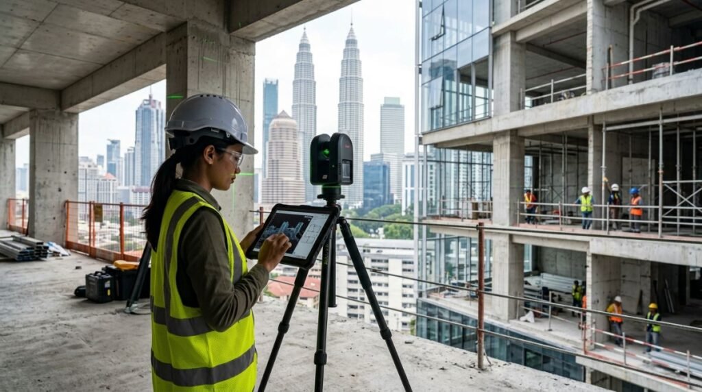
High-definition 3D LiDAR scanning—also referred to as reality capture or 3D terrestrial laser scanning (TLS)—has emerged as a vital safeguard against project cost overruns. Delivering millimeter-grade spatial telemetry into building information modelling (BIM) workflows, LiDAR allows project teams to detect spatial clashes virtually rather than during destructive on-site demolition or steel fabrication. This technical guide explores how 2026 LiDAR surveying systems mitigate financial exposure, enhance statutory compliance, and streamline commercial refurbishments across Malaysia.
1. The Real Cost of Construction Rework in Malaysia
Under statutory provisions including the Street, Drainage and Building Act 1974 (Act 133) and the Uniform Building By-Laws (UBBL 1984), structural modifications and spatial alterations must strictly align with approved architectural and structural plans. In brownfield developments and adaptive reuse projects, historical as-built blueprints rarely match actual on-site geometry due to unrecorded tenant modifications, thermal expansion, foundation settlement, or construction variances accrued over decades.
When engineering teams rely on manual tape measurements, laser distometers, and legacy 2D CAD files, spatial errors compound quickly. According to regional construction benchmarking, field re-fabrication of mechanical, electrical, and plumbing (MEP) ducting or structural steel elements accounts for up to 60% of contractor variation orders (VOs). At current Malaysian market labor and fabrication rates, resolving a single major service duct clash at an active high-rise site can cost upwards of RM 15,000 to RM 45,000 in direct delays, scrap materials, and equipment downtime.

2. 3D LiDAR Technology in 2026: Terrestrial vs. Mobile SLAM Systems
3D LiDAR (Light Detection and Ranging) calculates precise coordinates by emitting pulsed laser signals at rates exceeding 1 to 2 million points per second, measuring the time-of-flight (ToF) or phase shift of the reflected beams. The resulting output is a high-density, dimensionally accurate “Point Cloud” representing the scanned environment as a 1:1 digital twin.
In modern 2026 reality capture, engineering surveyors apply two primary capture methodologies depending on spatial constraints and required tolerances:
- Terrestrial Laser Scanning (TLS): Stationary tripod-mounted units (such as dual-axis compensated phase-shift scanners) achieving survey-grade accuracies of ±1.0mm at 10 meters. TLS is the gold standard for structural verticality audits, beam deflection measurements, load-bearing assessments, and precision plant-room spatial mapping.
- Mobile SLAM LiDAR: Handheld or wearable kinematic scanners utilizing Simultaneous Localization and Mapping (SLAM) algorithms. These capture dense indoor telemetry at rapid walking speeds with relative tolerances between ±5mm to ±10mm, significantly accelerating spatial verification across expansive multi-level commercial podiums, basement carparks, and transit concourses.
Both data streams conform to Malaysian Standard (MS) mapping coordinate systems, directly supplying georeferenced spatial point clouds for seamless conversion into parametric Revit or ArchiCAD environments.
3. Three Core Mechanisms Where LiDAR Prevents Budget Blowouts
Millimeter-Accurate As-Built Documentation
Standard architectural drawings rarely indicate structural deviations such as column out-of-plumbness, slab deflections, or uneven floor levels. By generating high-density point clouds, engineers capture surface deviations across every structural member. Utilizing these coordinates to develop Level of Detail (LOD) 300 to 400 BIM models ensures that bespoke components—such as curtain-wall glass modules, pre-cast concrete panels, and custom structural steel trusses—are fabricated strictly to real-world dimensions, eliminating expensive site modifications.
BIM Clash Detection and Pre-Fabrication Fitment
Integrating LiDAR point clouds directly into Navisworks or Solibri enables advanced automated clash detection. Engineering coordinators identify “hard clashes” (such as a 400mm chilled-water pipe colliding with a pre-stressed reinforced concrete beam) and “soft clashes” (insufficient clearance for fire damper maintenance per MS 1183 standards) before procuring materials. Resolving these discrepancies digitally avoids emergency on-site stoppages and contractor dispute claims.
De-Risking Complex Commercial Retrofits
Adaptive reuse of aging commercial assets in cities like Kuala Lumpur and George Town presents significant hidden risks. Deteriorated structural members or uneven floor slabs can compromise new tenant fit-outs. Integrating laser scanning allows early identification of structural settling or member deformations. Where severe structural movement or cracking is identified, developers can immediately consult certified engineers for structural repair consultancy to design targeted strengthening solutions before architectural finishes are applied.

4. Field Case Study: Commercial Retrofit in Kuala Lumpur
To quantify the financial impact of reality capture, consider a comprehensive commercial retrofit executed at a 14-story corporate office building in the Kuala Lumpur Golden Triangle:
- Project Scope: Complete MEP modernization, façade envelope replacement, and open-plan spatial reconfiguration across 185,000 square feet of gross floor area (GFA).
- The Challenge: The structure was built in 1993, and existing archive drawings failed to document multiple tenant alterations, including lowered slab penetrations and relocated primary riser ducts.
- The Technical Solution: Pro Inspect Solution deployed high-density terrestrial laser scanners alongside mobile SLAM mapping to capture the interior, ceiling voids, and MEP risers across all 14 floors in 5 working days. The data was registered to a global control network (±2mm accuracy) and converted into an LOD 350 Revit model.
- The Outcome: Clash detection protocols uncovered 47 critical spatial clashes—including 12 major conflicts where newly specified variable refrigerant volume (VRV) trunking intersected with primary shear wall brackets. Pre-emptive digital rerouting prevented an estimated RM 320,000 in scrapped ductwork fabrication, overtime labor, and project liquidated ascertained damages (LAD).
5. Integrating LiDAR with Comprehensive Engineering Inspections
While 3D laser scanning captures geometry, pairing spatial data with specialized diagnostic testing delivers a complete assessment of asset integrity. Pro Inspect Solution combines reality capture with licensed engineering evaluations across the asset lifecycle:
- Façade & High-Level Audits: In accordance with local council mandates for buildings exceeding five stories, pairing point clouds with thermal imaging and façade & roof inspection (drone) workflows identifies delaminated tiles, spalling concrete, and water ingress pathways without costly scaffolding.
- Surrounding Property Protection: Prior to deep excavation, piling, or basement retrofits, documenting adjacent structures using a dilapidation survey protects developers against third-party crack claims. Time-stamped point clouds establish indisputable baselines of pre-existing condition.
- Quality Assurance & Handover Audits: For residential and commercial handovers under the Housing Development (Control and Licensing) Act (Act 118), deploying high-definition scanning alongside a certified property defect inspection (DLP) verifies floor levelness, wall verticality, and overall workmanship against QLASSIC and CIS 7 standards.
6. Commercial Inquiry & Technical Consultation
Are you planning an adaptive reuse project, industrial facility expansion, or major commercial fit-out in Malaysia? Don’t let inaccurate drawings compromise your construction schedule and budget. Contact our engineering team for an on-site evaluation, quotation, and custom scanning proposal:
Frequently Asked Questions (FAQ)
What accuracy tolerances can developers expect from 3D LiDAR scanning in Malaysia?
High-precision Terrestrial Laser Scanners (TLS) provide survey-grade point accuracy within ±1mm to ±2mm up to 20 meters, ideal for structural alignment, steel beam deflection, and façade audits. Mobile SLAM-based LiDAR mapping units operate within ±5mm to ±10mm tolerances, optimized for rapid coverage of large commercial floor plates and service shafts.
How does Scan-to-BIM compare with traditional manual as-built surveys?
Traditional surveys rely on spot measurements that miss unrecorded deviations, ceiling void clashes, and wall out-of-plumbness. Scan-to-BIM collects millions of georeferenced points per second to generate comprehensive 3D digital twins, allowing engineers to identify MEP service clashes and structural anomalies digitally before physical construction commences.
Is 3D laser scanning economically feasible for smaller renovation projects?
Yes. The cost of a professional 3D LiDAR scan represents a minor fraction (often under 0.5% to 1.5%) of total renovation expenditure. By eliminating unexpected MEP re-routing, custom joinery re-fabrication, and structural site delays, LiDAR surveys typically deliver positive ROI by preventing a single major design clash.
What file formats are delivered from a 3D LiDAR survey?
Surveys typically yield structured or unstructured point clouds in formats such as RCP, RCS, E57, LAS, and PTS. These files import directly into industry-standard BIM platforms including Autodesk Revit, Navisworks, AutoCAD, and ArchiCAD for downstream spatial modeling and clash detection.
Contact Us / Certified Inspection & Engineering Consultation
Pro Inspect Solution, led by Ir Vimal, Professional Engineer, provides certified building condition assessments, structural integrity audits, handover defect inspections, and professional engineering advisory across Malaysia.
- 📍 Service Coverage: Kuala Lumpur, Selangor, and Nationwide Malaysia
- 📞 Phone / WhatsApp: +60 16-806 4902
- ✉️ Official Inquiries: inspectsolution.pro@gmail.com
- 🌐 Official Website: proinspectsolution.com
- 👷♂️ Lead Engineer: Authored & verified by Ir Vimal, Professional Engineer
Need Certified Property Inspection or Building Audit Services?
Get instant consultation and professional engineering advice from Pro Inspect Solution.
