
By Ir Vimal, Professional Engineer | Published on October 5, 2026
Maintaining structural integrity and asset longevity has become an indispensable engineering requirement across Malaysia’s urban landscapes. With rapid commercial growth throughout Kuala Lumpur, Selangor, Penang, and Johor Bahru, traditional building envelope audits that rely on suspended scaffolds, boom lifts, and gondolas increasingly present unacceptable occupational safety hazards, protracted project timelines, and inflated operational budgets. The modern, non-destructive alternative transforming commercial asset management is high-precision unmanned aerial vehicle (UAV) auditing.
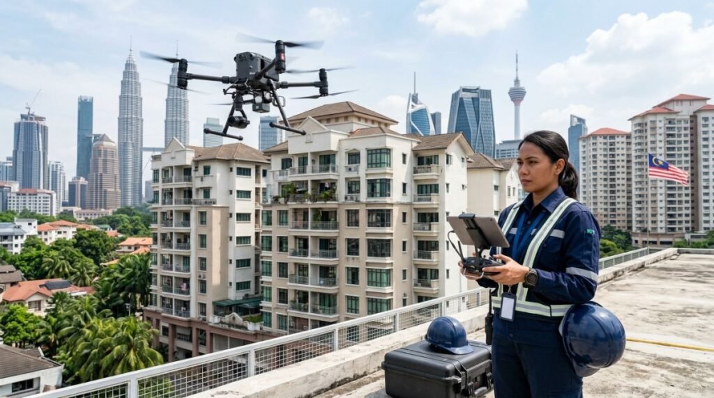
Deploying specialized aerial systems equipped with radiometric thermal imaging sensors and high-resolution photogrammetry enables developers, Joint Management Bodies (JMB), Management Corporations (MC), and industrial facility managers to identify external structural anomalies with exceptional safety and speed. Through systematic Façade & Roof Inspection (Drone) workflows, registered engineering teams can detect hairline concrete spalling, hidden moisture ingress, debonded tiles, and failing panel joints safely from ground level.
Table of Contents
- Malaysian Regulatory Benchmarks: CAAM and UBBL Compliance
- Drone Auditing vs. Traditional Access Methods
- Core Engineering Applications for Commercial and Strata Portfolios
- Integrating Aerial Data into Statutory Compliance (Act 133 & Act 757)
- AI-Powered Defect Mapping and Predictive Asset Care
- Frequently Asked Questions (FAQ)
Malaysian Regulatory Benchmarks: CAAM and UBBL Compliance
Conducting commercial UAV aerial audits in Malaysian airspace requires strict adherence to civil aviation governance. The Civil Aviation Authority of Malaysia (CAAM) regulates unmanned operations under the Civil Aviation Regulations 2016 (CAR 2016). Commercial structural inspections require certified pilots, formal risk evaluations, and statutory flight authorisations when deploying within controlled airspace, aerodrome traffic zones, or congested metropolitan areas.
Simultaneously, asset governance is anchored by the Street, Drainage and Building Act 1974 (Act 133) and local state Uniform Building By-Laws (UBBL 1984). Building owners, developers, and strata committees maintain a direct statutory duty of care to ensure exterior building envelopes and roof structures remain structurally sound and free from public hazards. Engaging registered engineers ensures that non-destructive aerial data converts into legally defensible audit dossiers that satisfy local municipal council (Pihak Berkuasa Tempatan – PBT) requirements.

Drone Auditing vs. Traditional Access Methods
Conventional facade inspection methodologies involving rope access teams, mobile elevating work platforms (MEWPs), and suspended staging are tightly constrained by occupational safety protocols governed by the Department of Occupational Safety and Health (DOSH). Working at height introduces critical fall hazards, demands complex permits to work (PTW), and routinely disrupts retail or road traffic at ground level.
By contrast, drone-assisted structural inspections deliver significant operational, economic, and technical advantages:
- Elimination of Work-at-Height Hazards: UAV pilots and structural engineers inspect complex cornices, parapet flashings, and expansive exterior facades from secure ground control stations.
- Substantial Cost Efficiency: Facilities eliminate extensive staging rental fees, temporary pavement hoarding costs, and multi-week access setup logistics.
- Rapid Field Turnaround: A multi-tiered industrial facility or a 40-storey strata tower that historically required four weeks of physical staging can be comprehensively mapped within two business days.
- Microscopic Defect Precision: High-resolution optical zoom optics paired with calibrated FLIR radiometric thermal sensors pinpoint delamination, hairline structural fractures, and interstitial water retention invisible to the naked human eye.
When severe envelope anomalies or concrete distress patterns are detected during an aerial sweep, property owners can transition directly into targeted rectification using certified Structural Repair Consultancy to engineer permanent structural rectifications.
Core Engineering Applications for Commercial and Strata Portfolios
Engineering-grade drone audits serve multiple critical functions across the property lifecycle in Malaysia:
1. High-Rise Facade Integrity and Tile Delamination Surveys
Malaysia’s tropical climate features heavy rainfall and intense solar thermal cycles, causing accelerated expansion and contraction in exterior plaster and mosaic tile adhesives. Aerial thermal scanning isolates thermal emissivity differentials behind tiled surfaces, identifying debonded sections before cladding falls onto pedestrian zones.
2. Industrial Roof and Gutter System Audits
Navigating fragile metal, asbestos-cement, or translucent skylight sheets on massive manufacturing plants poses significant breakthrough dangers. UAV platforms systematically inspect vast roof surfaces, logging corrosion spots, degraded flashing joints, blocked perimeter gutters, and dislodged anchor bolts without risking personnel safety.
3. Construction Handover and DLP Defect Audits
Prior to project completion or the expiration of the Defect Liability Period (DLP), commissioning an aerial Property Defect Inspection (DLP) verifies whether external architectural finishes, expansion joints, and roof waterproofing meet project specifications and CIDB CIS 7 (QLASSIC) quality thresholds.
4. Pre-Construction Structural Baseline Surveys
Before initiating heavy substructure excavation or deep piling operations nearby, developers execute an aerial Dilapidation Survey. High-resolution orthomosaics provide date-stamped photographic evidence of surrounding third-party structures to protect stakeholders against disputed structural damage claims.

Integrating Aerial Data into Statutory Compliance (Act 133 & Act 757)
Under the Strata Management Act 2013 (Act 757), Joint Management Bodies (JMB) and Management Corporations (MC) must maintain long-term capital expenditure (CAPEX) schedules for sinking funds. Comprehensive aerial photogrammetry provides building committees with exact volumetric data, enabling transparent contractor tender evaluations for facade repainting, spall repair, and membrane waterproofing replacement.
Furthermore, Section 85A of the Street, Drainage and Building Act 1974 (Act 133) mandates periodic visual and physical inspections of tall building facades older than ten years. When an aerial survey is planned, verified, and stamped by an engineer registered with the Board of Engineers Malaysia (BEM), the resulting digital defect register forms an acceptable technical baseline for local authority compliance.
AI-Powered Defect Mapping and Predictive Asset Care
The convergence of high-resolution photogrammetry, thermal imagery, and automated computer vision models is transforming Malaysian building maintenance. By generating complete digital twins of high-rise assets, engineering teams can track structural crack elongation, plaster deterioration, and water penetration year over year.
This predictive monitoring protocol ensures that strata managers and industrial asset operators shift from expensive, disruptive emergency repairs to cost-effective, scheduled preventative maintenance.
Frequently Asked Questions (FAQ)
Are drone facade and roof inspections accepted by Malaysian local councils?
Yes. When drone surveys are coordinated, analysed, and certified in an official engineering report by a qualified Professional Engineer registered with the Board of Engineers Malaysia (BEM), they serve as valid engineering submissions for local municipal councils (PBT), building insurers, and statutory compliance filings.
What weather conditions halt aerial drone building assessments?
Drone operations must pause during active precipitation, tropical thunderstorms, atmospheric haze, or sustained wind speeds that exceed operational safety parameters. Accurate thermal imaging and high-resolution optical capture also require stable ambient temperature gradients and clear optical line-of-sight.
How long does an aerial facade inspection take for a 30-storey building?
A typical 30-storey commercial or residential strata tower can be fully scanned on-site within one to two working days. Post-processing photogrammetry, defect classification, and the production of an endorsed engineering report are typically completed within 7 to 10 business days.
Contact Us / Certified Inspection & Engineering Consultation
Pro Inspect Solution, led by Ir Vimal, Professional Engineer, provides certified building condition assessments, structural integrity audits, handover defect inspections, and professional engineering advisory across Malaysia.
- 📍 Service Coverage: Kuala Lumpur, Selangor, and Nationwide Malaysia
- 📞 Phone / WhatsApp: +60 16-806 4902
- ✉️ Official Inquiries: inspectsolution.pro@gmail.com
- 🌐 Official Website: proinspectsolution.com
- 👷♂️ Lead Engineer: Authored & verified by Ir Vimal, Professional Engineer
Need Certified Property Inspection or Building Audit Services?
Get instant consultation and professional engineering advice from Pro Inspect Solution.
